The Epic Backcountry Adventure
The Great Basin Trail
Overview

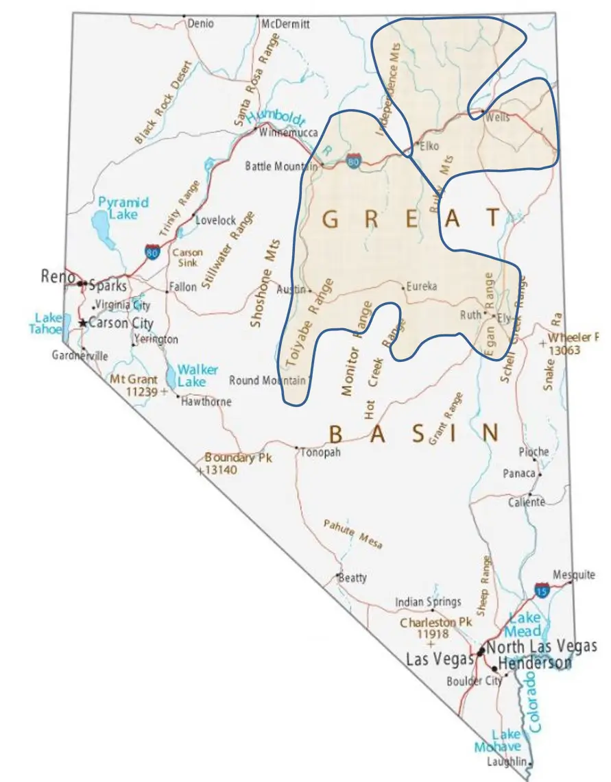
This map shows the location of the approximate trail corridor. Actual routes, though tentative, have been identified for most of the trail.
The Great Basin Trail is a concept for an awesome, long-distance backcountry loop trail in Northeastern Nevada. It will provide the ultimate multi-day adventure for those seeking to explore the remote outback of Nevada. It is designed for use by non-street legal off-highway vehicles (OHVs) like ATVs and SxSs, but it will also accommodate street legal vehicles like dual-sport bikes, 4WDs, and pickups if equipped for rugged off-highway use. From the high mountains to the valleys, and from the forests to the deserts, this trail will immerse the visitor in the rich history and heritage of the pioneers, ranchers, miners, and Native Americans. You will visit historic towns ghost towns, mines, hot springs, and famous sagebrush saloons. The variety of landscapes and experiences exceeds that of any other trail. A focus of the trail is education: What am I looking at? What happened here? Live like a pioneer while learning from the past.
The routes are still being determined, but it is estimated that the finished loop will exceed 1500 miles. The focus of the Great Basin Trail is the journey, not the destination. The system will comprise a combination of three types of routes:
- The Main Route connects towns or primary destinations. These are generally the most direct routes that still incorporate key features.
- Alternate Routes are just that. They provide a different and usually longer route to get there. Some are in higher or lower elevations. Others access different features or access additional services.
- Side Routes comprise the bulk of the mileage and serve several roles: Some are shortcuts for those in a hurry, low on fuel, or wishing to by-pass inclement weather. Others provide loop options for those who have more time and want to explore the area in more detail. Some are used to link additional camping opportunities, reservoirs, or unique features. Still others link portions of existing OHV trail systems. All of the routes are configured into loops.
While similar to the Arizona Peace Trail, this will be the longest adventure trail loop in the United States. It connects to communities with services like food, gas, and lodging, but this is the backcountry and those services may not be as close as some would like. However, it is very well suited for those who enjoy overland camping and can take their time to get to the next town. Are you ready for the challenge and experience of a lifetime? Hop on and hop off, commit to riding the entire trail, or stay and play, your epic backcountry adventure will start right here!

Near Austin. Ranching is part of the rich Nevada history.

Exploring mining ruins- an integral part of the Nevada landscape.
Goals of the Great Basin Trail:
- Showcase some of the best landscapes that Nevada has to offer
- Provide historical and geologic education and interpretation
- Stimulate rural Nevada economies
- Provide outstanding opportunities, experiences, and adventures for motorized recreationists
- Make Nevada the premier destination for national and international adventure/touring riders who seek the ultimate challenge and experience.
- Recreate the pioneering spirit and journey that made Nevada what it is today
Here are some highlights: (Note, all of this is draft and subject to change)
- Approximately 1500+ miles configured into two loops
- Side routes and alternate routes will almost double that figure
- Connects at least 15 towns, most of them rural
- Accesses about 7 ghost towns and one “living” ghost town (Midas)
- Incorporates at least 10 “sagebrush saloons” that are full of history, character, and folklore
- Links at least 20 historical or geologic points of interest
- Uses portions of the Donner-Reed expedition route, the Pony Express trail, the Overland Stage route, and the Emigrant trail
- Accesses 3 scenic byways and includes Lamoille Canyon in Elko and Ruby Lake National Wildlife Refuge
- Connects to existing OHV trail systems like Shoshone, Midas, Taylor Creek, Merritt Mountain, Wild Horse, Austin, and potentially some around Ely.
- Provides incredibly diverse scenery, 4000’ in elevation changes, topographic and vegetative diversity
- Travels through portions of 5 Counties: White Pine, Elko, Lander, Nye, and Eureka
- Includes lands managed by the State, Counties, Municipalities, private, the Humboldt-Toiyabe National Forest, and 3 BLM Districts- Elko, Ely, and Battle Mountain
Open to ALL modalities. No speed events allowed.
Touring an endless landscape, but what’s around that next bend?

Points of Interest
Historic, Geologic, Geographic, Other
- North Wendover: Donner-Reed Pass
- East Montello: Patterson Pass
- SE Mountain City: Wild Horse Reservoir
- South Elko: South Fork State Recreation Area
- Austin Town
- Austin: Stokes Castle
- Kingston Town
- SE Round Mountain: Belmont Courthouse
- East Kingston: Diana’s Punchbowl
- East Kingston: Toquima Cave
- East Austin: Nevada Geographic Center
- East Austin: Summit Mountain
- Eureka Town
- Ely: Ward Charcoal Ovens
- Ely: Cave Lake State Recreation Area
- Ely: Nevada Northern Railway
- East Ely: Success Mine
- North McGill: Schellbourne Pass
- North McGill/Hwy93: Historic Monument
- East Ruby Lake: Mountain Spring Pony Express Station
- Ruby Lake: Ruby Valley Pony Express Station
- Ruby Lake: Bressman Cabin
- Ruby Lake: Fort Ruby
- Ruby Lake: Ruby Lake National Wildlife Refuge
- West Ruby Lake: Harrison Pass Guard Station
- South Wells: Spruce Mountain Mining District
- More…

The incredible Ward Charcoal Ovens in Ely

The Outback is full of joys and surprises


An old mining cabin in Lewis Canyon

Bressman Cabin at Ruby Lake

Above, the Nevada Northern Railway in Ely
Ghost Towns

The Metropolis Arch in Wells
Hopes and Dreams Long Gone….
- NW Wendover Area: Shafter
- NW Wells: Metropolis
- North Elko: Dinner Station
- North Battle Mountain: Midas (almost ghost town)
- SE Eureka: Belmont
- SE Eureka: Hamilton
- SE Eureka: Treasure City
- North Ely: Cherry Creek
- Spruce Mountain: Sprucemont

Remnants of Treasure City
Scenic/Historic Routes
- Wendover: Silver Island Scenic Byway
- North Wendover: Donner-Reed Expedition Route
- East Jackpot: California Trail National Backcountry Byway
- Jarbidge: Jarbidge River Canyon
- Elko: Lamoille Canyon Scenic Byway (street-legal vehicles only)
- Elko: Elko-Hamilton Stage Route
- Battle Mountain: Lewis Canyon Scenic Drive
- Ely: Success Loop Scenic Drive
- SE Ruby Lake: Pony Express Route
- SE Ruby Lake: Overland Stage Route

Some Locals Come Over To Say Hello

A portion of the Pony Express Trail south of Ruby Lake. The GBT uses 50 miles of this route. Can you imagine?
Sagebrush Saloons
Local Character, History, and Fun


Lucky Spur Saloon
- Midas: Midas Saloon & Dinner House
- Tuscarora Area: Taylor Canyon Cub Bar & Café
- Jarbidge: Red Dog Saloon
- Jiggs: Jiggs Bar & Cafe
- Kingston: Lucky Spur Saloon
- Belmont: Dirty Dick’s Saloon
- Eureka: Urban Cowboy Bar & Café
- Ruby Lake: Harmon’s Bar
- Montello: Cowboy Bar & Café
- Elko: Lone Mountain Station
- Manhattan: Manhattan Bar & Motel

Harmon’s Bar, Ruby Lake

Somewhere on the Shoshone Range

Yep, we’re in Nevada!

The wonder and joy of discovery and touring. Near Austin.

An Overland Camper’s Dream
There’s a saying that it isn’t the destination, it’s the journey. Overland campers live and enjoy that journey to the fullest. Nevada is known for its dark skies and outstanding stargazing opportunities. Add to that the quiet stillness of the outback and you have a camping experience made in heaven.


Note: These pictures are taken from the web and are intended to show overland camping gear. TGBT.ORG does not endorse any vehicle type or brand of vehicle or aftermarket product.

Photo by TheDyrt

Photo by Thomas Tucker on Upsplash

Photo by John Allen
Timeline:
The trail utilizes existing routes and those routes are in the process of being identified. Ground-truthing and verification of those routes will begin in June 2024, so at least a portion of the system will be open and available for use by the fall of 2024. It is hoped that the entire system will be open by the summer of 2025.
Navigation:
There will be little to no on-the-ground signing. Potential riders will purchase geo-referenced maps and will navigate by their mobile devices. An 8” or 10” tablet with GPS would be the ideal device. Maps will be available through the Avenza map store and through thegreatbasintrail.org.
OHV Registration/Licensing:
- All OHVs must be registered in Nevada or another state
- Out-of-state registrations are good for 15 days
- Helmets are required for all drivers and passengers when operating on a county, town, or city-maintained road (Note:org recommends that seatbelts and helmets be worn by all occupants at all times)
- OHVs may operate on any unpaved public or county road. They may operate up to 2 miles on a paved road for the purpose of accessing services or to reach another trail connection.
- For complete information, go to ohv.nv.gov
Safety:
- Riding with other vehicles is highly encouraged
- This is the backcountry. Survival and self-sufficiency skills are recommended
- Expect the unexpected. Storms can make routes impassable in an hour
- Always be prepared to spend the night in the field
- Monitor the weather. Route conditions can change with every storm. Washouts may occur. Wash and stream crossings may become impassable
- Cellphone service may be spotty or non-existent
- Travel these routes like the pioneers- at your own risk
More information:
This site will be updated on a regular basis. If you would like to be placed on The Great Basin Trail mailing list, please send a request to the contact below.
Contact: info@thegreatbasintrail.org
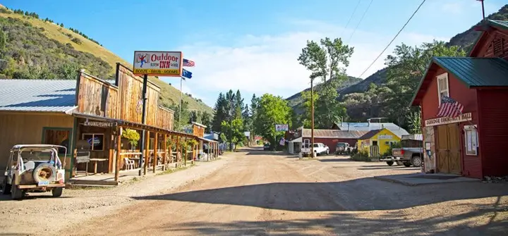
The quaint and scenic town of Jarbidge.
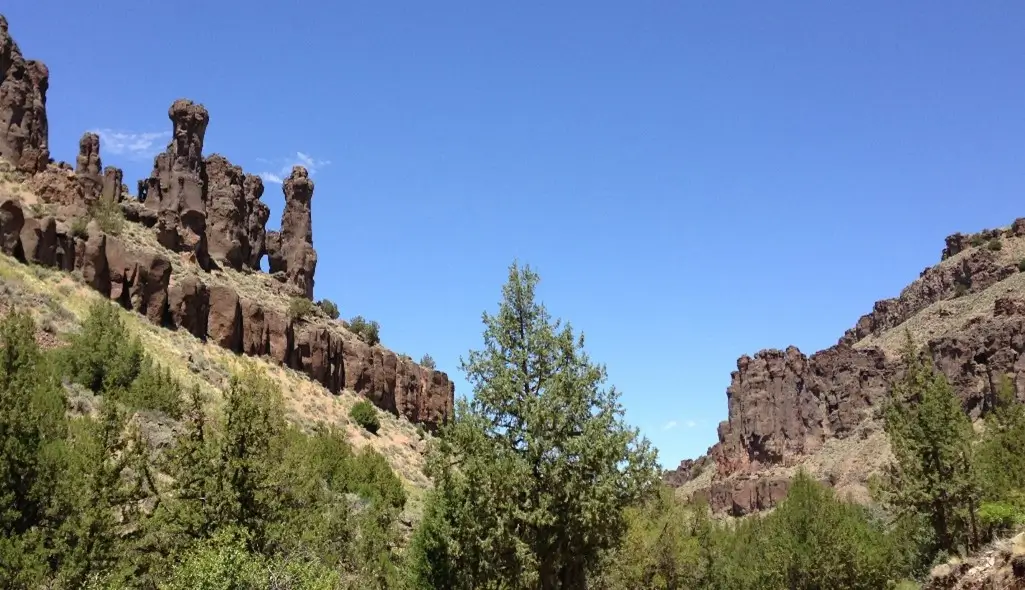
Spectacular hoodoos in the Jarbidge River Canyon.
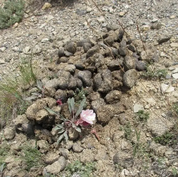
Beauty and the Beast. A truly Nevada scene where wild horses nurture the wild flowers.
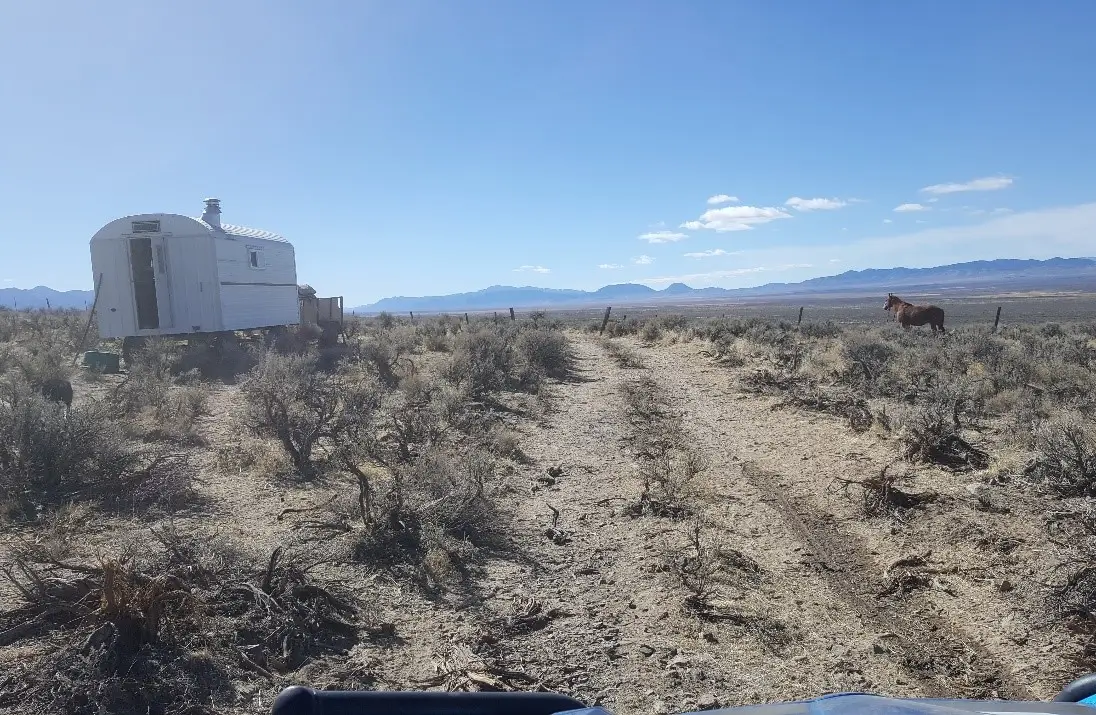
The sheepherder’s wagon and his horse. A classic scene that hasn’t changed in 150 years.
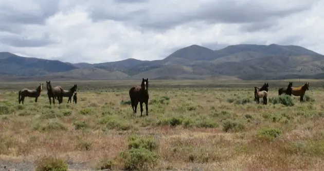
Touring riders are thrilled to see wild horses - A symbol of beauty and freedom.